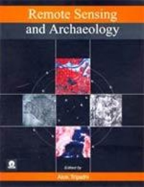
Space technology h as enormous applications in the field of archaeology. Data generated through satellite remote sensing have successfully been utilized for better understanding of evolution of man and his activities in the past. This book provides an introduction to the remote sensing technology and its applications in the field of archaeology. It exposes archaeologists to the modern scientific development in the field of space technology by presenting basic technological information in a simple language. It contains research articles contributed by expert scientists which illustrate practical applications of remote sensing methods in various fields of archaeology for identification of buried or sunken ancient sites, delineation of large monuments, palaeochannels and quantitative geomorphological mapping, monitoring and management of archaeological sties. A number of case studies of ancient Indian cities, like Kausambi, Srasvasti, Sisupalgarh, Nalanda, Dvaraka, Ujjain, Baroda, Hampi, and Adams Bridge, Indo-Gangetic Plain, etc. demonstrate utility of high resolution remote sensing data. Studies of palaeo-channels of Sarasvati, Sabarmati, Banas, etc. in Haryana, Punjab, Rajasthan, Gujarat, and Tamil Nadu included in the book are of great significance for understanding palaeo-environment and geomorphological changes for archaeological interpretation. The book would bring the archaeologists and scientists together for utilization of latest technology in the field of archaeology for study and preservation of cultural heritage.
Remote Sensing and Archaeology
$79.20
$88.00
In stock
Free & Quick Delivery Worldwide
All orders amounting to US$ 50 or more qualify for Free Delivery Worldwide. For orders less than US$ 50, we offer Standard Delivery at $14 per book.
ABOUT THE AUTHOR Alok Tripathi
Dr. Alok Tripathi, born in 1965 at Gwalior, obtained his Masters Degree in A.I.H.C. and Archaeology and Sociology from Jiwaji University, Gwalior and Doctor of Philosophy from M.S. University of Baroda. He has participated in archaeological excavations at Karbabhat and Sorar, Sopara, Paithan, Dholavira, Rakhigarhi and Ojiyana. He is a diver and has participated in underwater excavations at Dwarka in the Arabian Sea; Transquebar and Kaveripattnam in the Bay of Bengal; Calanque de I' Ann (France); La Pointe Lequin (France); Cala Culip VI (Spain) in the Mediterranean Sea and Saint Vaast La Hougue (France) in the English Channel. He is presently heading the Underwater Archaeology Wing of the Archaeological Survey of India. He is Director of excavation of a shipwreck Princes Royal off Bangaram Island and excavation at Elephanta Island, in the Arabian Sea and excavation at Mahabalipuram in the Bay of Bengal. He has visited France, Spain, Monaco, Denmark, U.K., Hong Kong, Macau SAR China and Nepal. He is the author of 'Excavation of Princes Royal', 'Recent Excavations in Rajasthan' and editor of 'Proceedings of the International Seminar on Marine Archaeology' and 'Remote Sensing and Archaeoogy'. Besides he has published more than 50 research papers in various reputed journals and other volumes.
reviews
0 in total
Review by Anonymous
Be the first to review “Remote Sensing and Archaeology” Cancel reply
You must be logged in to post a review.
Bibliographic information
Title
Remote Sensing and Archaeology
Author
Edition
1st ed.
Publisher
ISBN
8175741554
Length
xxiv+307p., Figures; Tables; Maps; References; Plates; Index; 25cm.
Subjects



There are no reviews yet.