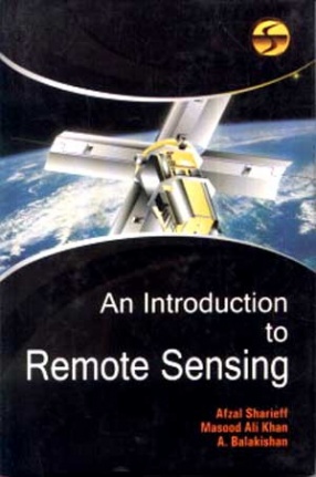
Remote sensing may be taken to mean the observation of, or gathering information about, a target by a device separated from it by some distance. The expression remote sensing was coined by geographers at the US Office of Naval Research in the 1960s at about the time that the use of spy satellites was beginning to move out of the military sphere and into the civilian sphere. Remote sensing is often regarded as being synonymous with the use of artificial satellites and in this regard one may call to mind glossy calendars and coffee-table books of LANDSAT images of various parts of the Earth of the satellite images that are frequently shown on television weather forecasts. Satellites do play an important role in remote sensing but it should be appreciated that remote sensing activity not only precedes the expression but dates from long before the launch of the first artificial satellite. There are a number of ways of gathering remotely sensed data which do not involve satellites and which, indeed, have been in use for very much longer than satellites. For example, virtually all of astronomy can be regarded as being built upon the basis of remote sensing data. However this book is concerned with terrestrial remote sensing.
An Introduction to Remote Sensing
$28.80
$32.00
In stock
Free & Quick Delivery Worldwide
All orders amounting to US$ 50 or more qualify for Free Delivery Worldwide. For orders less than US$ 50, we offer Standard Delivery at $14 per book.
ABOUT THE AUTHOR A Balakishan
Dr. A Balakishan has obtained his Ph.D. in Geography from Osmania University. He is currently Associate Professor of Geography at the Centre for Indian Ocean Studies, Osmania University, Hyderabad. His areas of interests include- Indian Ocean, Remote Sensing, GIS, Urban and Environmental studies.
ABOUT THE AUTHOR Afzal Sharieff
Professor Dr. Afzal Shariegg did his M.A. in Geography form OSMANIA University. Dr. Sharieff started his teaching career in a secondary school, teaching social studies and geography. Later he was selected as a associate professor in the University. He was promoted as a reader on the basis of his work and promoted as a full fledged professor. Dr. Sharieff has attended many national seminars and workshops. He is a member of many professional bodies and he lectures on geographical issues. He writes for national newspapers and magazines.
ABOUT THE AUTHOR Masood Ali Khan
Dr. Masood Ali Khan obtained his M.A. and Ph.D. in Sociology from Dr. B.R. Ambedkar Marathwada University, Aurangabad. He started his career as UGC Research Fellow, Dept. of Sociology in the same University. Presently he is working as Deputy Director, southern Regional Centre, ICSSR, Osmania University. His area of interest are information Technology in Social Sciences, Minority Problems, Urdu Press and Sociology of Islam. He has published many articles of different nature both in national and international journals. Dr. Khan has conducted more than 50 Seminars, Workshops and Research Methodology Courses sponsored by SRC-ICSSR. A widely travelled person, Dr. Khan has attended many national / international seminars / conferences.
reviews
0 in total
Review by Anonymous
Be the first to review “An Introduction to Remote Sensing” Cancel reply
You must be logged in to post a review.
Bibliographic information
Title
An Introduction to Remote Sensing
Author
Edition
1st ed.
Publisher
ISBN
9788176256544
Length
x+122p.,
Subjects




There are no reviews yet.