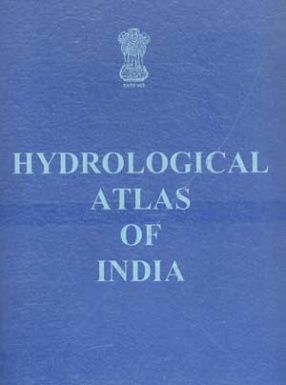
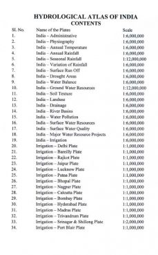
The science dealing with the waters of the earth, their distribution on the surface and underground and the cycle involving evaporation, precipitation is known as 'hydrology'. The importance of this discipline was understood much earlier in our ancient civilization. The location of cities and important settlements along the rivers and near water bodies is the testimony of it. The lay out of settlements and building plans are with reference of the availability of their resources that may not be as scarce as we find it today. The association of history and civilization established the importance of rivers and other water bodies as the prime resource necessary for all forms of life on earth. According to the Markandya Purana all rivers are sacred, all flow towards sea. All are like mothers, all purge away sins. Indians consider their waters as sacred. It has been stated in ancient scriptures that the water of river Yamuna purify a man after a bath of seven days, those of Saraswati after a bath of three days, those of Ganges immediately on taking the bath; and those of Narmada on their mere sight. Regarding Tapi, it has been stated that mere remembering her purifies a man. The Hydrological Atlas of India is an attempt of the NATMO to transfer the knowledge so far collected by different concerned departments to the users and researchers, through a set of thematic maps showing hydrological setup of the country along with all the interrelated elements of geology, physiography, climate, soil, natural vegetation and land use. It provides an overview of the water potential of both the surface and ground water and their quantity, quality and availability. The map content provides logical links between physical and social environments. Each of the maps shows different aspects of water for a better understanding of natural environment, its interaction with the social and economic activities. Water, thus viewed is a highly valuable and mobile resource. The users of this Atlas are likely to be exposed to one of the great system of the nature, the hydrologic system of our country and its impacts on environment and human civilization. This Atlas should be useful to the governments, institutions and individuals who are working on water related issues. Further, it may provide some background information for possible interlinking of rivers in the country.
Hydrological Atlas of India
Add to favorites
Contents
$144.00
$160.00
In stock
Free & Quick Delivery Worldwide
All orders amounting to US$ 50 or more qualify for Free Delivery Worldwide. For orders less than US$ 50, we offer Standard Delivery at $14 per book.
ABOUT THE AUTHOR Prithvish Nag
Prithvish Nag, (b. 1951), M.Sc. (Gold Medalist), Ph.D., is the Director of the national Atlas and Thematic Mapping Organisation (NATMO) of the Ministry of Science and technology, Government of India. He has been the President of the Indian National Cartographic Association, Indian Association of Special Libraries and Information centre, Institute of Indian Geographers, Indian Institute of geomorpholists, Professor S.P. Chatterjee Memorial Foundation and Indian Geographical Foundation. At the international Level, he was the Chairman of the International cartograqphic Association (ICA), Commission on Population Cartography, UN/PCGIAP Committee on Institutional Strengthening for Asia and the Pacific, International Steering Committee on Global Mapping (ISCGM), Working Group on data Standardization, and Full member of the International geographical Union (IGU), Commission on Population geography, and Member, Editorial Board, International Journal on geographical Information System. Dr. nag was the Visiting member of the Staff of the School of Oriental and African Studies, London. He is an Author and editor of over 35 boos and 110 research papers. His well known books are geography of Indian and Digital remote sensing. Dr. nag was UN Consultant in cartography in the Sultanate of Oman and the Surveyor general of India.
reviews
0 in total
Review by Anonymous
Be the first to review “Hydrological Atlas of India” Cancel reply
You must be logged in to post a review.
Bibliographic information
Title
Hydrological Atlas of India
Author
Edition
1st ed
Publisher
Length
Maps; Index
Subjects
more by Prithvish Nag see more
Indian Geospatial Infrastructure
$64.80
$72.00
similar bookssee more
Perspectives in Botanical Museums
$19.95
$21.00
Family Herbal: Comprising a Description, and The Medical Virtues
This book presents a ...
$59.40
$66.00



There are no reviews yet.