50 books





1. Uttar Pradesh (1:1,500,000); 2. Bihar (1:750,000); 3. Rajasthan (1: 1, 500, 000); 4. Maharashtra (1: 1, 500, 000); 5. Andhra Pradesh (1: 1, 500, 000); 6. Tamil Nadu (1: 1, 000, 000); 7. Punjab (1:500, 000); 8. Himachal Pradesh (1:500, 000); 9. Jammu & Kashmir (1:2,000,000; 10. Meghalaya (1:500,000); 11. Assam (1:1,000,000); 12. Manipur (1:500,000); 13. Tripura (1:250, 000); 14. Goa (1:250, 000); 15. Nagaland (1:500,000); 16. Mizoram (1:500,000); 17. ...

India is a large country with different facets. It is known for its diversities, physical and cultural. It has always been a challenge to depict a broad picture of this nation-state. Volumes have been written, huge data has been collected and surveys of all kinds have been carried out. Even such valuable efforts have been less effective in bringing out a comprehensive picture of the country. Our earlier attempts of preparing the ...


Gandhiji, the father of the nation, considered Punjab the most important province of India. It is the land where the first civilized man trod on earth endowed with the bounties of nature. The state is blessed by seven perennial rivers and innumerable tributaries. These rivers and their tributries spread carpets of alluvial soil on its vast plains.
The objective of this atlas is to provide a basis for all round development. This atlas has an additional ...


This atlas on the state of Bihar is adorned with a fascicule of thirty six maps. Here an attempt has been made to portray the overall appraisal of the state’s environment and resources along with human impact. Keeping view of the information available, the thematic maps at suitable scales and layout have been chosen. In order to do so, authentic district and block level available data was procured from different government offices which have been analysed, ...


The environment, science and technology are burning issues in the country. We were benefited by the two atlases prepared recently. These are (a) Environmental Atlas of the India in collaboration with Central Pollution Control Board, and (b) Sciences & Technology Atlas of India in collaboration with the National Science & Technology Management Information System (NSTMIS) division of the Department of Science & Technology. We have included one volume on ...

Here is the Socio-Economic Atlas that offers a useful and informative introduction to the world of maps on economic and social aspects of India. It is based on census and extra-census information, which is compiled by different appropriate methods. This atlas is also enriched by sizeable write-up on each map. This volume consists of twenty-seven maps covering physical, social and economic aspects of the country. Starting with the administrative map with the ...

This atlas is not a collection of locational maps of the conventional type. It contains a number of specialized maps, based on field and library work, carried out by the author for a number of years. The observations and statistics were then plotted on large scale maps, mainly for the purpose of teaching the geography of Bengal to University post-graduate students. Some of the maps were subsequently exhibited in a geographical exhibition, opened in Calcutta by ...

The National Atlas and Thematic Mapping Organisation (NATMO) was entrusted by the Department of Science and Technology, New Delhi of the Government of India to organisse the year long programmes to Commemorate the centenary celebrations of Padmabhusan Prof. S. P. Chatterjee, during the period 22nd February 2002 to 22nd February, 2003. In this connection, the NATMO organised the seminar, entitled "National Seminar on Geography and Applied Cartography", ...

Indian Ocean Atlas can be divided into three broad themes: physiographic characteristics and its bed, socio-historical, and economy, trade and natural resources of physical and economic importance. These themes are to meet the following objectives : (a) to reestablish India's intimate relationship with the ocean and the littoral countries, (b) to provide an assessment of the marine resources which would be required in near future, and (c) to provide a basis for ...

Within the Scientific community of the country, it has long been felt that India's considerable scientific and technological strengths require to be effectively projected both within the country and abroad. Publication of a Science and Technology Atlas of India is a step in that direction. In this Atlas an attempt has been made to bring out the spatial dimension of science and technology initiatives in the country. For being instrumental in homogenous ...

Mapping of resources of the country and an evaluation of their present status and future potential is a national issue. Accordingly, the National Atlas and Thematic Mapping Organisation, Department of Science and Technology, Government of India, took up compilation of several atlases depicting the basic resources of the country. The present work is a part of that attempt. An effort has been made to bring out a set of popular maps and, thus, this present Abridged ...
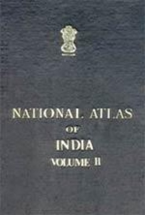
This time natmo included several maps of new themes in 10 volumes (previous edition was in eight volumes) consisting of 243 maps. All the maps in the present atlas prepared on the basis of latest available authentic data are designs of exclusively to provide an analitical study on the general and Environmental, Population, Economic and Social and cultural features of the country. Thus the atlas firms a great storehouse of information covering a wide spectrum of ...
