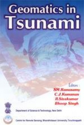
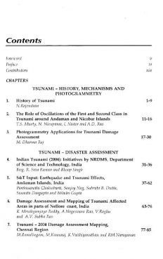
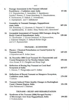
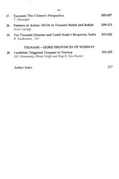
The Asian “Mega Tsunami†(2004) has struck most of the territorial nations of South Asia including the East coast of India. The NRDMS Division, Department of Science and Technology, Government of India, New Delhi, has conceived and executed an All India Co-ordinated programme on “Tsunami Disaster Assessment and Mitigation†through various, institutions of expertise on Geomatics in Earth System Dynamics and the related natural disasters. The Geomatics technology which includes Arial Photography, Photogrammetry, Satellite Remote Sensing, Digital Image Processing, GPS Surveys, GIS modeling etc. was used in this programme, geospatial data bases were created on Tsunamic disasters over Natural, Physical and Human Resources and futuristic mitigation strategies were evolved therefrom. The book illuminates the results of the studies carried out along the Indian Coast and a bird’s eye view on the tsunami studies in Norway. In addition, some special papers on the role of mangroves as Tsunami mitigator, Impacts of Tsunami over marine water quality, coral ecosystem etc; the administrator’s experience over the tsunami crisis management, NGO’s perspective, certain societal issues triggered by the killer Tsunami and citizen’s perspective, etc. also find a place in this volume. A multi-disciplinary book adequately illustrated with satellite images, photographs and figures beneficial to: Students, researchers, field level professionals and the administrators in the arenas of environment, coastal ecosystem, disasters, coastal vulnerability, remote sensing, GIS etc.
ABOUT THE AUTHOR Bhoop Singh
Bhoop Singh, Director (NRDMS), Department of Science and Technology, government of India, has over 22 years of expertise in formulating a large number of research projects in the areas of disaster management and mitigation and natural resources management in India. He has visited a number of Asian and European Countries on scientific missions to imbible technology know-how in various research programmes on natural disasters in India. He is currently handling a bilateral programme on Geo-hazards (tsunami and landslide) in collaboration with International Centre for Geo-hazards, Oslo, Norway. How he is involved in promoting research programmes on geospatial databases for local level planning and in areas of natural disaster mitigation (especiallyon Tsunami and Landslide) in India.
ABOUT THE AUTHOR Brig. R. Sivakumar
Brig. R. Sivakumar, Head of NRDMS and NSDI, Department of Science and Technology, Govt. of India, New Delhi, holding the rank of Brigadier in Indian Army is basically a Production Engineer and acquired additional Diploma in photograpmmetry from ITC, The Netherlands and Ph.D. on Multi source digital topographic database from IIT, elhi. He has served in various capacities in Indian Army and specialized on the advanced consepts of surveying and photogrammetry based mapping in survey of India. Presently, in addition to heading NRDMS and NSDI, sphere heading the NSDI movement in India. He has received a number of honors and awards both from India and abroad.
ABOUT THE AUTHOR C.J. Kumanan
C.J. Kumanan, Senior faculty, Centre for Remote Sensing, Bharathidasan University, Tiruchirappalli 620 023, has specialized in the application of Remote Sensing and Geospatial technology in Earth System Sciences related to Mineral Exploration, Water Resources and Natural Disasters. Due to his experience in divergent Geological provinces in India, for over two decades as a Geologist from Geological Survey of India, in association with the senior editor, evolved and implemented many novel academic programmes, handled a large number of sponsored Research projects/published a number of papers and edited 2 volumes and serving on several academic bodies.
ABOUT THE AUTHOR S.M. Ramasamy
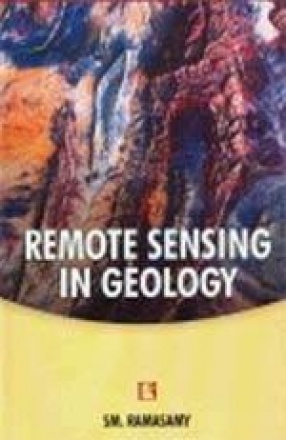
S M Ramasamy, an eminent field geologist and a known specialist in the field of remote sensing, has been actively engaged in geological studies in diverse settings across the country -- during the last one or two decades. His research findings have been published in the form of scientific papers in different national/international journals and conference volumes. This book is a compilation of a selection of 18 of his research papers dealing with various applications of remote sensing in the broad fields of structural geology, palaeotectonics, neotectonics and active tectonics. Most of the included studies are pertaining to Western and Southern India. After serving as a Geologist for over a decade with the Geological Survey of India, S M Ramasamy is currently, Prof and Director, Centre for Remote Sensing, Bharathidasan University, India.


There are no reviews yet.