
Sunderban is composed of a group of Islands comprising the area from the mouth of river Hoogly on the west and extends up to the river Meghna in the east covering from the districts North and South 24 Parganas within the Indian Territory and Khulna and Barisal in Banladesh. It lies between 21.0 and 21.20 North latitude 88.0 and 89.0 longitudes occupying an area of 9827 sq. km of which 4264 sq. km falls within the jurisdiction of India. The name Sunderban drives from the Sundari tree which is prominent in this area. vegetation includes wet evergreen mangrove forest. The area is further divided into three zones: Inhabited zone (2) Buffer zone and (3) Core area. Pioneering work on Indian spider by Tikader by Tikader (1980 & `982) describe only one species from Sunderban. Mondal & Nandi (1989) reported the occurance of seven genera under four families without pointing any species level from Sunderban areas. Majumdar & Tikader (1991) described one species and reported three species from Sunderban mangrove areas. Biswas & Biswas (1992) reported 17 species in 15 genera under seven families from this area. Biswas (1995) reported one species from Hugly Malta estuarine system. Majumdar (2004) in his monumental works on Sunderban spider reported 108 species in 36 genera under 13 families from this area. Among them three species are new to science and 38 species are new record from this area. Majumdar (2005) also described another four species from Sunderbans.
Studies on Taxonomy and Diversity of Spiders from Darjeeling Hills
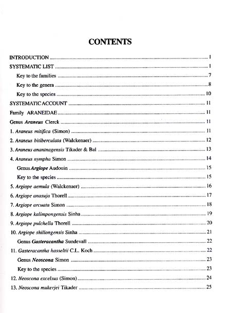
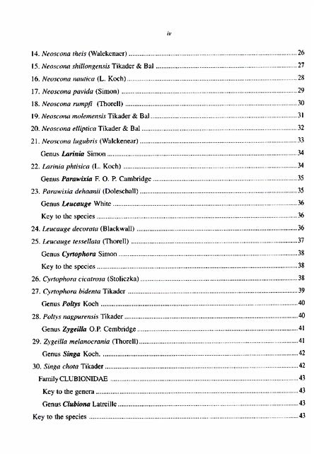
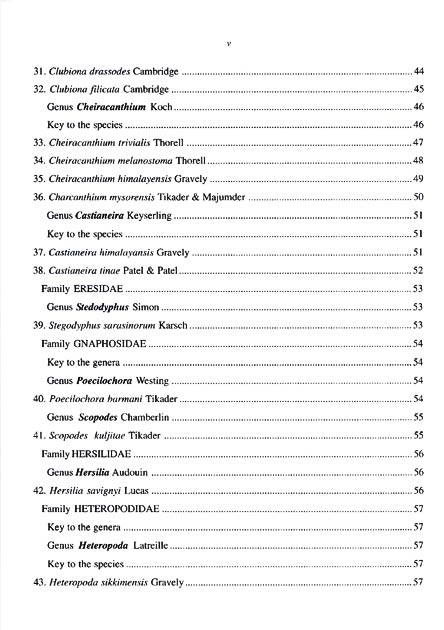
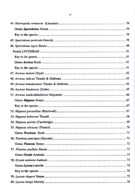
Contents: 1. Introduction. ...
$54.00
$60.00


There are no reviews yet.